Friday, August 24, 2018

Will travel for science

A number of months ago I was asked if I would give one of the plenary talks at the New Zealand Marine Sciences Society Conference. I was really honored to be asked and excited about the conference because it was being held in Napier this year, a place neither Pete or I had ever visited. I flew down on a Tuesday to attend the conference and Pete drove down on Friday to join me. We had hoped to make it a long weekend, but field work harkened us back to Auckland a day sooner than we had hoped. 

The conference was great, as always. When we arrived in New Zealand last year, I went to the same conference, which was a great way to start my time in the country. A year later, it was a great way to end my time in NZ. There are many familiar faces at this conference, so it was a chance to say "see ya" to many I would not have seen otherwise. 

Napier, which sits on Hawke's Bay on the eastern side of the North Island, is an interesting town unlike any other place in NZ. The town was nearly completely destroyed by an earthquake in 1931, which is still NZ's deadliest natural disaster. When the city was rebuilt, they decided to rebuild in the art deco style of the time. It is one of two cities in the world with the best-preserved art deco buildings (South Beach, Miami in Florida is the other).


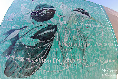
The other, perhaps less celebrated part of Napier that I loved was her murals. Most of them have an ocean theme and were incredible. I love walking around a town searching for street art and finding hidden gems in unsuspecting places. 


After exploring the town, we headed south to Napier's sister city, Hastings, to hike Te Mata peak. The geology of the peak was really interesting and the views of the surrounding wine growing region and mountains were spectacular. 


We started our drive back to Auckland the following day. We were trying to get to a friend's house near Whakatane for dinner, so we drove a lot and stopped a little. Although it made for a longer drive, we decided to drive through the heart of Te Urewera. For those of you that have seen The Wilderpeople, the movie was filmed here. (If you haven't seen it, fix that! It is a fantastic film.) Te Urewera used to be a national park but was demoted to simply a protected area at some point in the recent past. It has a very mysterious feel to it but is beautiful. It was a blustery, grey day when we drove through, adding to the feel. Waikeremoana--the large lake that is the centerpiece of the area--was fast changing and wind swept. 

We did two short hikes in the park, the first in a grove of tawa trees. The leaves of the tawa trees are a bright yellow-green color, which is quite different than the deep green color of most NZ trees. It also made the forest feel light because the leaves are very thin and numerous. Also along this track is one of the largest northern rata trees in the country. The tree is roughly 1,000 years old, but it didn't start its life on the ground; it started it in the crook of another tree. Rātā trees send down very long roots from their perch that eventually encompass the host tree. The "trunk" of a rātā is not really a trunk at all, but rather a whole bunch of fused roots that form a hollow, psuedo-trunk. 

bright leaves of the tawa tree

northern rātā in the middle with its telltale tufty foliage

pseudo-trunk of the rātā - can you see the individual roots?

the trees were singing as they swayed in the strong
wind, adding to the mysterious and magical feel of the place

Lake Waikeremoana

Our second hike was to Aniwaniwa Falls, a set of three waterfalls interspersed with tranquil bits of river. I should count, but I'm pretty sure we've seen more waterfalls in our 13 months in NZ than I've seen in my 15 years in California. 


The road from Te Urewera back to civilization felt nearly as remote as the reserve itself. There were very small settlements every 10 km or so, horses roamed free, and we hardly saw another soul. We made it to Papamoa in time for a delicious feast with our former coworkers, Ange and Kristy. It was really good to see them and the lives they are building for themselves outside of Auckland. We certainly miss having them on our team, but are happy they are doing well. 

Papamoa beach

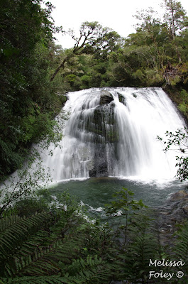
After a yummy breakfast and a walk on the beach, we started our journey towards Auckland. Our driving time was much shorter than the previous day, so we decided to stop at Wairere Falls, the tallest waterfall on the North Island. The waterfall is in the Kaimai Mamaku Forest Park. Like so many other places in NZ, this forest seemingly materializes out of the gazillion dairy farms in the region. 

The hike to the waterfall lookout was beautiful! Given the surrounding paddocks, it was nothing like I expected. There were giant boulders and beautiful, clear streams crisscrossing the track frequently. There were lots of mosses, ferns, and native trees. The 153 m waterfall was pretty spectacular too. We decided to forego the hike to the top based on the weather forecast for high winds and heavy rain. Based on the weather we drove through after our hike, I think we made a good decision. 


We drove a lot of kilometers and traversed a lot of landscapes in a weekend. I'll call that another successful Wish trip. 

Saturday, August 18, 2018

Our last NZ vistor

Pete's sister Erin came out to NZ for a visit in mid-June. Being winter in the southern hemisphere, we were not really sure what to expect for weather. Typically it doesn't rain for days around Auckland, but we warned Erin to come prepared with a rain coat and rain pants pants just in case because we would adventure rain or shine. I think our preparation worked well...the weather was spectacular! It rained while Erin was in NZ, but it was like the weather gods were smiling on her. It rained while she slept and the sun came out when she woke. The only day of rain was her museum day in Auckland, which was a perfect day for inclement weather. 

We had ten days to show Erin the best of the upper North Island. I think we did a pretty good job, if I do say so myself. We crossed nearly all of Erin's travel goals off the list and had lots of fun doing so. Pete and I got to visit some new places that were on our list and revisit some or our favorites. 

We headed north for our first tiki tour to the tippity top of NZ, Cape Reinga (Te Rerenga Wairua). This is a sacred place for Māori because this is where souls depart Aotearoa New Zealand for the underworld. There is an 800-year old pohutukawa tree at the point that is said to be where souls slide down the root and into the sea where they travel to the Three Kings Islands and ultimately to their ancestral home, Hawaiiki-A-Nui. Cape Reinga is also the point where the Tasman Sea and Pacific Ocean meet. The seas were pretty calm when we were there so there were no dramatic clashes of the two water bodies (not really separate water bodies, but the currents flow in opposing directions, causing them to collide at the Cape). It is a lonely view from the top of NZ with nothing but ocean for miles and miles (or kilometers and kilometers). 

nothing but ocean beyond that lighthouse


If you look very closely, there is a small tree on the right
side of the last rock that rises out of the ocean. That is the
800-year old pohutukawa tree that souls slide down. It isn't
a very big tree because it lives a harsh life out there on the cliff.


Just south of the Cape are the Te Paki giant sand dunes. We had so much fun exploring, climbing, leaping, and running down these spectacular dunes. The angle of repose was so steep on some of the dunes that I felt like I was going to fall backwards off the dune while trying to climb up. Climbing in other people's footsteps was key to making any upward progress! There were a lot of interesting features on the dunes, including water lines, outcrops of less erodible sandstone, and lots and lots of shells.

Pete in the foreground for scale

example of an outcropping of more consolidated sand

dendritic sand channels from water runoff

preparing for the steep climb to the top

success!

the best part - the jump down

getting some serious air

A bit farther down the coast, we walked along 90-mile beach, which is actually closer to 90 kilometers, but oh well. The beach used to be the main thoroughfare for people traveling down the west coast before the road was paved and maintained. There were a few vehicles on the beach that day, which felt a bit odd in part because there are very few beaches in California where vehicles are allowed and also because the people were driving quite fast. We found a gull that had met it's demise by one of these speeding vehicles, which was sad. The beach was also completely inundated with a juvenile shellfish called tuatua.  

the lovely golden sand of 90-mile beach


relief in the sand caused by hundreds of tuatua

The sand was very boggy where the tuatua were located such
that if you stood on a patch of beach for fifteen to twenty
seconds, your feet sunk into the mass of the tuatua juveniles.

We stayed on the Karikari peninsula on the north side of Doubtless Bay. The bay supposedly got it's name from Captain Cook who wrote in his ship log, "doubtless, this is a bay." We nearly had the holiday park to ourselves, which facilitated some good games of Splendor, a favorite of Pete and Erin. Near our holiday park was the Lake Ohia gumhole reserve. The department of conservation website described it as "an other-worldly place of charred stumps and gumland scrub that casts a strange sort of magic over you." With that kind of description, you have to check it our, right?! The short trail led us on a circuitous path amongst several holes in the ground that were dug deccades ago by men searching for kauri gum, a treasure worth more than gold, buried in the wetland. The magic was a bit lost on us, unfortunately, but we now know what a gumhole looks like, I guess?

old gumhole

family photo

From the far north, we made our way south to the Waipoua Forest to show Erin the big kauri trees. Her visit was well timed because the NZ government is thinking about closing visitor access to the infamous giants, particularly Tāne Mahuta, the largest kauri in NZ. Biologists worry that Tāne Mahuta may be infected with kauri dieback disease within a year because the disease has been found within meters of the tree. The disease spreads through the soil and is currently 100% fatal to the trees. Officials are worried that if people are still allowed access to the tree that they could speed up transmission of the disease, even though everyone is supposed to clean their shoes and stay on the extensive boardwalk. But you know humans...we don't always do what we are told. We cleaned our shoes well and got to see the giants from the safety of the boardwalk.

At the southern end of Waipoua Forest is a very small kauri reserve called Trounson. This is Pete's favorite place, so he was very excited to have another chance to visit it. This kauri forest is a bit of an island in the middle of farmland and is supposedly home to little brown kiwi. The holiday park we stayed at occasionally runs night tours to look for the iconic native bird. We decided to venture out on our own a bit after sunset with our red lights (they are much nicer for wildlife) and keen ears. We had walked about three-quarters of the track when Pete and I noticed that Erin had stopped a bit behind us. She was standing very still for quite a while. She motioned us back, and lo! there was a little brown kiwi!! It foraged for a few more seconds near the boardwalk before ambling off into the forest. Seeing a kiwi in the wild is a pretty big deal. When we reported our sighting to our work mates, most (who are from NZ) exclaimed that they had never seen one in the wild. We felt blessed and truly grateful.

Pete and Erin being very responsible shoe cleaners

Tāne Mahuta, the biggest kauri tree in NZ

Te Matua Ngahere - the girthiest kauri in NZ

We made a few other stops along our journey, including one of our favorite places, Waipu Cave, to show Erin the magical glowworms. We also made a pit stop at the showiest toilets around - the Hundertwasser in Kawakawa. They are apparently the most photographed toilets in the country. Seems like the competition might be low for that honor, though.

searching for eels

some kind of troll-hair fungus that grows on poo

spelunker extraordinaire

cool cave formations formed by water eroding the limestone

glowworms! (the green dots)

Cave weta!!! I was so excited when Pete found this.
With legs and antenna, this weta was about eight inches long!

Hundertwasser

Artwork inside the women's toilets

Haruru Falls

columnar basalt at Haruru Falls

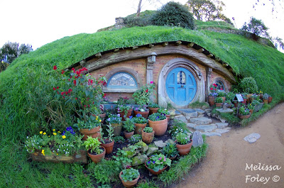
For our second tiki tour, we headed south to the star attraction of Erin's visit...HOBBITON! Lord of the Rings and The Hobbit are big tourism draws for NZ. But Hobbiton is the only set from the movies that still exists as it was during filming. The Shire, where the hobbits live, was originally built on a sheep farm in the Waikato Region for the Lord of the Rings films and was dismantled after the filming was done. It was rebuilt for The Hobbit and the land owners somehow convinced Peter Jackson, the director, that the Shire should remain after filming ended. Hobbiton, as it is now called, is a major tourist destination. I enjoyed reading The Hobbit book and watching the LOTR and Hobbit movies, but was a bit skeptical about Hobbiton. I am happy to report that it was AMAZING! We had a beautiful day and a good tour guide, which was key. It was just so cool to be walking around the Shire. We even got a beverage at the Green Dragon, and of course followed our tour with a bit of elevensies. 


a hobbit hole


overlooking the Shire

Bag End, home of Bilbo Baggins (and Frodo too)

another well-appointed hobbit hole

hobbit laundry

the Green Dragon

beer or ginger beer served at the end of every tour

another view of the Shire


Elevensies

Even the i-site in Matamata has gotten into the Hobbit spirit

From Hobbiton, we continued south to Rotorua, home of geothermal wonders. We took Erin to a new geothermal site that we had not visited, Orakei Korako. This was one of the largest silica terraces in NZ until a dam was built and the terraces were flooded in the reservoir. Part of the terrace still survives, though, and there are many features above the lake level. The colors, formations, and temperatures were so varied in a relatively small amount of space that it was quite remarkable. The visitor center is on one side of the lake and the site is on the other, so you have to take a very short boat ride across the lake to get to the trail. Someone is watching the dock from the visitor center and they send the boat over to pick you up when you finish the walk. 

Silica terrace that continues down into the reservoir
that was formed when the river was dammed.


the whole hillside was smoking!


the boat and very short ferry ride across the lake

geothermal bathroom humor


Orakei Korako is quite close to Lake Taupo, NZ's largest lake and caldera of the Taupo volcano. The Waikato River drains Lake Taupo and shortly after it leaves the lake, the 100-meter wide river channel is squeezed through a 15-meter wide canyon. The resulting Huka Falls is a sight to see. The flow is fast and furious and could fill an olympic-sized swimming pool in 11 seconds! 


 We visited some new places in Rotorua too. We took a stroll around the Government Gardens, a lovely park setting complete with sculpture and rose gardens. We visited Saint Faiths church, an Anglican church situated on a marae (Māori meeting grounds). The church is adorned with tukutuku panels on the walls, a Māori art form that is common in meeting houses. The church has many other features from Te Ao Māori, including the Galilee window of Jesus wrapped in a kiwi feather cloak walking on Lake Rotorua. 

Government Gardens and bowling lawns

Saint Faiths Anglican church

 tukutuku panels - the designs all have a meaning

The light was so bringht that Jesus is walking on the grass instead of the water.

We also went to the Redwood Forest, part of the research forest in Rotorua. We hadn't visited before because we thought, we come from the redwood forest we don't need to see this one. Our first trip was at night to do the canopy walk. A dark canopy walk might sound odd, but they have really cool lanterns strung from the trees that you get to see while walking from tree to tree. We went back during the day and were surprised by how different the trees look there than they do in their native habitat. Redwoods grow six times faster in NZ because it rains all year round, whereas in California it mainly rains from November to April. The young trees are really different too; they shoot up like scraggly little Charlie Brown trees until they are about four feet tall and then they start filling out. It was all very interesting. 


We made it back to Auckland in time to see the sun set from our maunga (mountain), Ōwairaka. We were so happy Erin could visit us and that we managed to see so many things during our winter outings. It promptly started raining the moment we dropped Erin off at the airport and rained for three days straight after she left. I really do think she was our lucky charm.