The Council shuts its doors for two weeks around Christmas and New Years, so we took advantage of our long break from work and took a road trip to the South Island. Until we moved here, Pete and I had individually spent most of our time on the South Island. I did research in the rocky intertidal from 1999 to 2006 and drove around the island many times to work our sites on the east and west coasts. Pete did a road trip in 2004, visiting many places around the island. Our trip was structured around some favorite spots we wanted to revisit and a few new places to check out.
We decided to take the ferry to the South Island instead of flying so we could have our Wish called Wanda for camping. We were really happy to have her! It rained on and off the first five days so having a dry place to sleep was fantastic. The ferry leaves from Wellington, about eight hours south of Auckland, so getting there was leg 1 of the trip.
We stopped halfway to Wellington at Tongariro National Park. For you Lord of the Rings and Hobbit fans, the area was the set for Mordor and the volcanoes in the park were used as Mount Doom and the Lonely Mountain. Unfortunately, the cloud level was low and it was raining so we didn't get to see either. But we still managed a hike through the unique alpine vegetation and neat geological features formed by ongoing volcanic eruptions and lahars (mud flows).


True to Wellington's nature, it was windy when we arrived at the ferry dock and the ocean was awash in white caps. However, our boat was enormous so we could barely feel the weather once we were underway. The crossing takes about 3.5 hours and the scenery once the boat enters the Marlborough Sounds is beautiful.


We spent our first couple days on the South Island on the east coast, mainly revisiting places we knew well that had been affected by earthquakes in 2011 and 2016. The coastal road between Picton and Christchurch recently opened after being closed for over a year after a 7.8 magnitude earthquake rocked the region. The earthquake caused horizontal movement of over two meters along some of the fault ruptures and vertical uplift of over seven METERS in some areas along the coast, drastically changing the intertidal and subtidal habitat. This was our first look at the most heavily changed areas...and it was unbelievable! I had seen photos of the intertidal very soon after the quake, showing algae, invertebrates, and fish perched high above the ocean. Seeing it in person was something else. All of the critters that were left high and dry have all since died and decomposed, but the crustose coralline algae left a very visible sign of uplift. The white bands on the rocks in the photos below used to be underwater.


We decided to take the ferry to the South Island instead of flying so we could have our Wish called Wanda for camping. We were really happy to have her! It rained on and off the first five days so having a dry place to sleep was fantastic. The ferry leaves from Wellington, about eight hours south of Auckland, so getting there was leg 1 of the trip.
We stopped halfway to Wellington at Tongariro National Park. For you Lord of the Rings and Hobbit fans, the area was the set for Mordor and the volcanoes in the park were used as Mount Doom and the Lonely Mountain. Unfortunately, the cloud level was low and it was raining so we didn't get to see either. But we still managed a hike through the unique alpine vegetation and neat geological features formed by ongoing volcanic eruptions and lahars (mud flows).

alpine beech trees
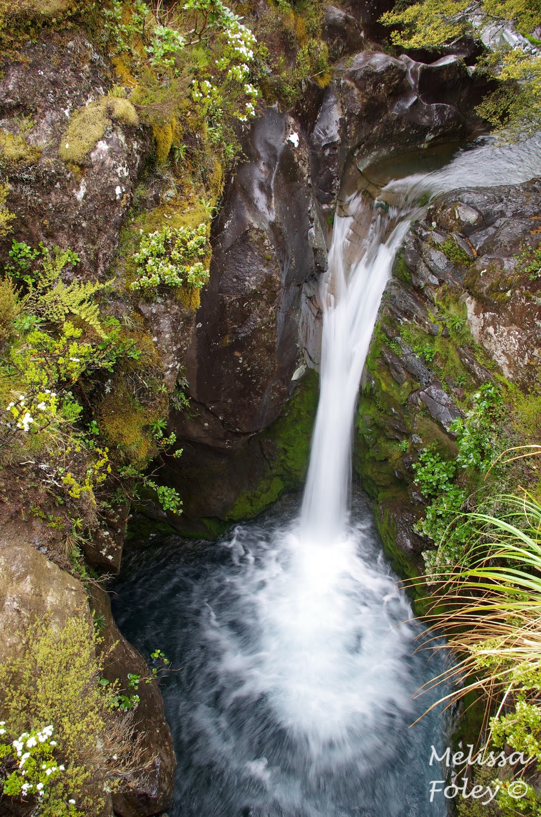
small waterfall

big waterfall - Taranaki Falls

lots of interesting lichens

and cool alpine mosses and plants

edge of the mud flow

a dreary day...but fitting for Mordor
We continued our travels south on Christmas day, stopping for a picnic lunch on the beach that was adorned with NZ's natural Christmas tree.

pohutukawa in full bloom
True to Wellington's nature, it was windy when we arrived at the ferry dock and the ocean was awash in white caps. However, our boat was enormous so we could barely feel the weather once we were underway. The crossing takes about 3.5 hours and the scenery once the boat enters the Marlborough Sounds is beautiful.

at over 500 feet long, she was the largest boat either of us had been on

coming into the calmer waters of the Marlborough Sounds
We spent our first couple days on the South Island on the east coast, mainly revisiting places we knew well that had been affected by earthquakes in 2011 and 2016. The coastal road between Picton and Christchurch recently opened after being closed for over a year after a 7.8 magnitude earthquake rocked the region. The earthquake caused horizontal movement of over two meters along some of the fault ruptures and vertical uplift of over seven METERS in some areas along the coast, drastically changing the intertidal and subtidal habitat. This was our first look at the most heavily changed areas...and it was unbelievable! I had seen photos of the intertidal very soon after the quake, showing algae, invertebrates, and fish perched high above the ocean. Seeing it in person was something else. All of the critters that were left high and dry have all since died and decomposed, but the crustose coralline algae left a very visible sign of uplift. The white bands on the rocks in the photos below used to be underwater.

ridge of intertidal uplifted between 50 cm and 1 meter

rocks uplifted up to 3 meters
While the most recent earthquake resulted in some dramatic changes, uplift and erosion has been the name of the game on the Kaikoura Peninsula for thousands of years, creating interesting geological formations. This area of the coast wasn't really affected at all by the recent earthquake.

limestone layers and swirls

red-billed gull on a stack of limestone

NZ fur seal resting on the rocks
Two big earthquakes in 2010 and 2011 (7.1 and 6.3, respectively) hit Christchurch, a major city in NZ about 200 km south of Kaikoura. The 2011 earthquake caused more damage than the larger 2010 quake, likely because structures were already weakened. Christchurch and the port town of Lyttleton were immediately transformed. This was the first time either of us had been into the heart of ChCh where heavy damage occurred. Despite nearly seven years elapsing since the quakes, rebuilding still seems in its infancy in central ChCh. In the center of the CBD (central business district) was the Anglican Cathedral, a stone church that partially collapsed in the quakes. The ruined church still stands in the square while decisions about its fate make their way through the court system. Many buildings around the CBD have been demolished, leaving me completely disoriented in a city I once knew well. Lyttleton suffered the heaviest losses in the second earthquake. The epicenter was only a couple kilometers away from the hilly port town. Entire blocks of the town were demolished and still stand empty.

empty lots in Lyttleton

new mural in Lyttleton - this community is strong

the western side of the cathedral

a stone in the sidewalk outside the art centre containers -
"kia kaha" means "stay strong" in Māori
"kia kaha" means "stay strong" in Māori
Rebuilding is occurring slowly. The Cardboard Cathedral was constructed in 2013 for the displaced cathedral community. Shipping containers transformed into shops and restaurants have sprung up all around the city as temporary storefronts. We even found our favorite Greek restaurant - Dimitris - in the container mall. Despite these efforts, though, the heart of ChCh felt like a shadow of its former self. On a sunny afternoon two days after Christmas, the CBD was mostly empty.

the cardboard cathedral was designed by Shigeru Ban -
he has desinged similar temporary "disaster" structures in Japan
he has desinged similar temporary "disaster" structures in Japan

86 cardboard tubes make the a-frame structure

the arts centre - a favorite of mine - partially functions out
of these containers across the street from its original location
of these containers across the street from its original location

I rarely wish I could still eat gluten...except when we found Dimitris!
From ChCh, we headed inland toward the Southern Alps, the mountain range on the South Island. Our first stop was a bit out of our way...but it is a place I have wanted to explore since I first started going to NZ in 1999. Kura Tāwhiti (treasure from afar) is a landscape dotted by karst formations. The limestone originated in a shallow inland sea that was exposed and eroded over time. Winding through the tors felt like being in a giant's jungle gym.


Pete - for scale

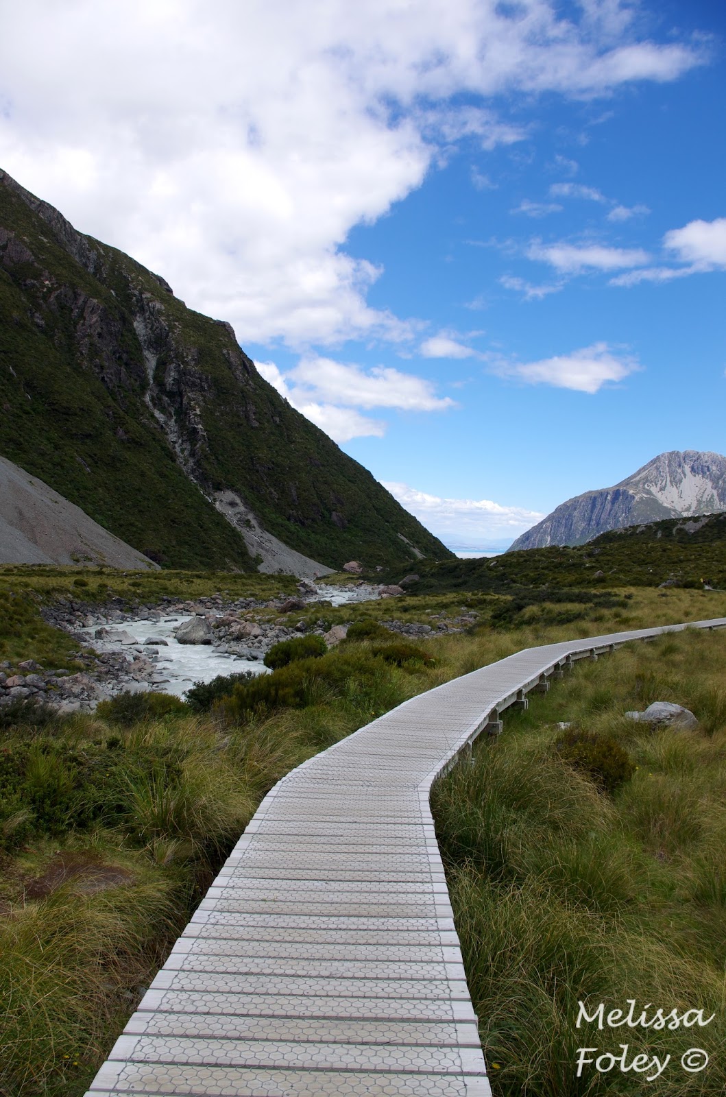
After our detour, we headed to Aoraki National Park (Mount Cook) for more hiking. We hiked into the Hooker Valley, a lovely hike up a river valley to the Hooker Glacier, including three swing bridges, which I knew would entice Pete. Similar to Tongariro, the alpine vegetation was new and interesting and the views were spectacular!


so many of the rivers coming off the mountains
disappeared into the rocky scree before emerging
again at the bottom before entering the river
disappeared into the rocky scree before emerging
again at the bottom before entering the river


a lonely iceberg from the Hooker Glacier

The terminal face of the Hooker Glacier. The glacier is rapidly
melting - over 40 meters per year. It is getting covered with
sediment from the eroding slopes as it retreats up the valley.
melting - over 40 meters per year. It is getting covered with
sediment from the eroding slopes as it retreats up the valley.

they don't mess around with trail construction in this country!


milky river outflow from the glacial till

Our hike up the Hooker Valley was a trial of sorts. Pete injured his knee a couple months ago and he wasn't sure how it would hold up to hiking long distances. He did well on this 3 hour hike, which was great because our planned hiking for the next two days was five to six hours each day. We had contingency plans if things changed, but our planned hike was a go! We hiked 10 miles up the Macaulay River to a hut nestled against the cliffs of the river valley (and back out the next day). Most people drive to the hut, but the Wish isn't exactly built for river crossings and large boulders. We had two days of beautiful weather, amazing scenery, and good company at the hut. The hut system in NZ is pretty amazing. Most huts are built and maintained by the Department of Conservation, but the Macaulay Hut was built by local groups about twenty years ago and they still work together to maintain it. It is used mainly by hunters who are looking for Himalayan tahrs (goats) that were introduced to the valley by a game farm in the 1960s. The hut sleeps 14, has a full kitchen, running water, lights, and a loo with a spectacular view.

The Macaulay River is one of the South Island's beautiful braided
rivers. This means that the river valley is wide but there is only
water flowing in a few channels when it isn't flooding.
rivers. This means that the river valley is wide but there is only
water flowing in a few channels when it isn't flooding.

we crossed the river many, many times

giant boulders from rockslides

we think these are lichens - anyone??

our home for the night

view up the valley from the hut


The moss communities in the river bed were
really neat. They reminded us of coral reefs.
really neat. They reminded us of coral reefs.
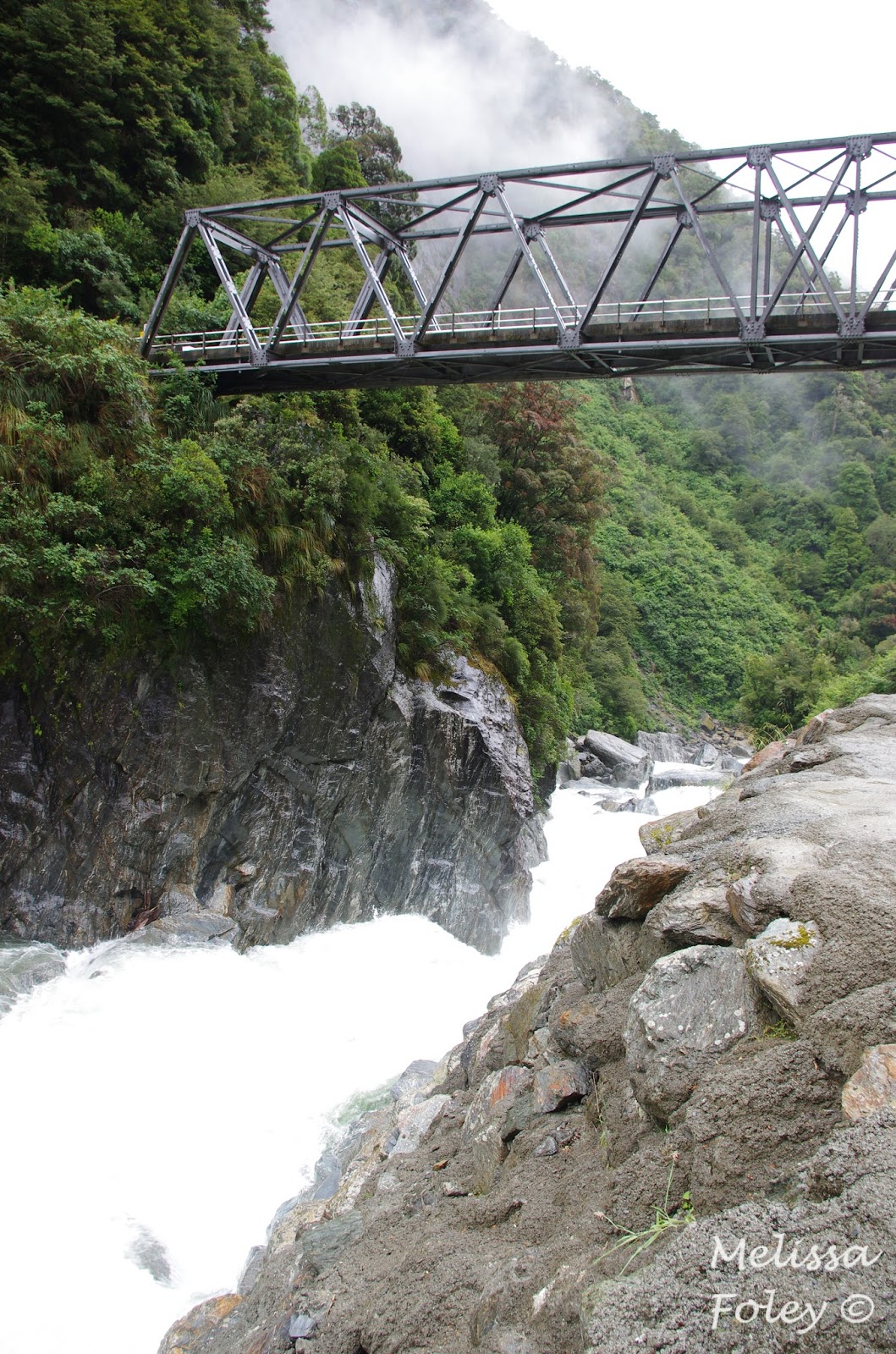
From the Macaulay, we headed south past the clay cliffs and then west. We spent the rest of our trip on the west coast, a wild and unpopulated part of the country. This area is usually best summarized as rainy and full of sandflies (terrible biting insects). It rained as we crossed the Haast pass, but when we arrived into Haast, the sun was shining and there was a light breeze keeping the sandflies at bay. It was divine! We rang in the new year in Haast and then continued to one of our favorite spots, Punakaiki. This place is famous for the pancake rocks, but the Porarari River Valley takes the cake for us. We rounded out the west coast with a hike across the Buller River on NZ's longest swing bridge before heading to Nelson so spend time with our friend Robyn and her mum, pooch, and ponies. It was the perfect way to end a great trip.

The clay cliffs are a seemingly random outcropping on private
land, just a few hundred meters away from the main road.
Thanks for the recommendation, Stacie!
land, just a few hundred meters away from the main road.
Thanks for the recommendation, Stacie!

Evidence of how water has shaped the formation
The Haast river roars through the Gates of Haast

Roaring Billy Falls - one of the many waterfalls along the Haast Pass

Hillside covered in blooming Southern Rata trees

Photographic evidence of our fabulous weather in Haast. A rare treat!

One of our favorite places along the west coast -
the Porarari River gorge. So, so lovely!
the Porarari River gorge. So, so lovely!

Punakaiki is always a treat with its pancake rocks and blowholes

Pancake Rocks

Longest (110 m) swing bridge in NZ across the Buller River


The view across Robyn's property was perfect for relaxing
It was difficult to go back to work after two weeks of being outside...